|

Maps and Mapping Software by National GeographicUse the search button at the top to find the map or software for your needs!
We have the full database online!
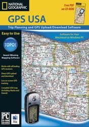
GPS USA - Upload, download software for GPS USA
Price: $24.95
Quantity in Basket: none
The software of choice for those who want an easy-to-use GPS waypoint manager and trip planning tool without all of the detailed maps included in the TOPO! State Series and Back Roads Explorer software. GPS USA includes three levels of overview atlas-level maps for the entire U.S. Features:
Seamless atlas maps for the entire U.S.
GPS users can upload and download waypoints and routes
Unlimited waypoint storage
GPS Route Wizard
Elevation profiling - draw a route and TOPO! generates a chart showing distance and elevation
Enhanced shaded relief that can be toggled on or off
Add your own notes, symbols, photos, and web links to the maps
Select the exact area you need and print in landscape or portrait on any inkjet, laser printer, or plotter
Choose from lat/lon or UTM grids
Use the USA Place Finder to search over 1 million campsites, lakes, summits, and campgroundsAvailable for Windows operating systems.
System Requirements
Windows: 95, 98, ME, 2000, XP, NT 4.0 and higher. Works with all color and black & white printers supported by these operating systems.
Macintosh: OS 9.0 or above, or OS 10.2 or above. Works with all color and black & white printers supported by Mac OS 9 or Mac OS 10.
TOPO!Alabama
Price: $99.95
Quantity in Basket: none
TOPO!Alabama $99.95 TrailSmart Ç 15 Major National Parks of the USA
Price: $29.99
Quantity in Basket: none
TrailSmart Ç 15 Major National Parks of the USA, 29.99 Arc Software Extensions for GIS (PCºs only), TOPO! Image Support for ArcGIS
Price: $499.95
Quantity in Basket: none
Arc Software Extensions for GIS (PCºs only), TOPO! Image Support for ArcGIS $499.95 TOPO! for ArcGIS, Multi-layer Edition
Price: $999.95
Quantity in Basket: none
TOPO! for ArcGIS, Multi-layer Edition New! $999.95 GPS USA
Price: $24.95
Quantity in Basket: none
GPS Waypoint Manager and Trip Planner Easily transfer waypoints, routes, and tracks between your GPS and PC. Plan and record your adventures across the USA using world-renowned National Geographic Atlas maps and add your own photos, notes, and web links!
With GPS USA you can:
See your waypoints, routes, and tracks anywhere in the USA (including Alaska & Hawaii).
Draw a route on the map and automatically convert the route to a specified number of GPS waypoints - ready for uploading.
Use your home computer to create and store thousands of waypoints, routes, and tracks.
Plan trips and send waypoints or routes directly to your handheld GPS.
Display your current position and route on a moving map - great for in-vehicle laptop use.Other Features...
Use the USA Place Finder for easy access to millions of recreational destinations - ready for uploading to your GPS.
Print your own custom maps on regular paper or National Geographic's waterproof Adventure Paper (sold separately).
Export customized maps in a number of different raster file formats (.gif, .jpg, etc.) for use in other applications.
Add map border information to printouts including UTM or latitude/longitude grids, scale bars, north arrows, and magnetic declination.
Toggle between NAD27 and WGS84 datums in UTM or latitude/longitude.GPS USA works with most receivers made by Garmin, Magellan, Eagle, and Lowrance